
You get to see some amazing 3D detail from the October update onward.
Here is the full album of the high res shots.
 |
| Earth |
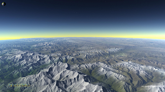
Here are two good ones of the Himalayas from space.
| From Earth |
 |
| From Earth |
The new Earth is a multi resolution combination of many data sources:
Elevations:
ETOPO1 is used as a 1KM global base map of relief and bathymetry:
Amante, C. and B. W. Eakins, ETOPO1 1 Arc-Minute Global Relief Model: Procedures, Data Sources and Analysis. NOAA Technical Memorandum NESDIS NGDC-24, 19 pp, March 2009
http://www.ngdc.noaa.gov/mgg/global/global.html
CGIAR-CSI SRTM is layered onto it to provide a high resolution 90M land layer.
Jarvis A., H.I. Reuter, A. Nelson, E. Guevara, 2008, Hole-filled seamless SRTM data V4, International Centre for Tropical Agriculture (CIAT), available from
http://srtm.csi.cgiar.org.
We will continue adding sections as further super high resolution 10M datasets such as Hawaii, Maui and Mount St. Helens as we have time, but these will probably appear after the main release.
Colour Data
Colour data is generated procedurally and partially sourced from the blue marble images. Each further update of Earthsim will generate more colour procedurally and hence allow Earthsim to better model seasonal variation. To do this we will be using seasonal rainfall and temperature maps.
No comments:
Post a Comment